Trails and terrain in the Dolomites and the Alps
The Dolomites and the Alps are among the most well-known and appreciated mountain environments in the world for enthusiasts of hut-to-hut trekking. These mountains are characterized not only by their stunning landscapes, but also by the wide variety of terrain they offer. During an hiking tour in the Dolomites, and more generally in the Alps, you find yourself hiking on different terrain at every leg, surrounded by constantly changing natural environments and vegetation. Each environment has its own specific characteristics and requires a different way of walking.
For those coming from overseas, but also for anyone who is not used to living and moving in the mountains, it is often difficult to imagine what alpine terrain is like and how to best prepare for a multi-day trek. You may walk across wide green meadows, pass through dense forests, tackle steep rocky slopes at mountain passes, cross unstable scree fields typical of the Dolomites, or, at higher elevations, encounter snowfields and glaciers.
Being aware of the terrain you will be facing helps you prepare more effectively and enjoy hut-to-hut hiking with greater safety and pleasure.
ALPINE VEGETATION ZONES
The variety of alpine terrain is closely linked to the zonation of vegetation, which changes with increasing altitude and directly influences both trail conditions and the way you walk.
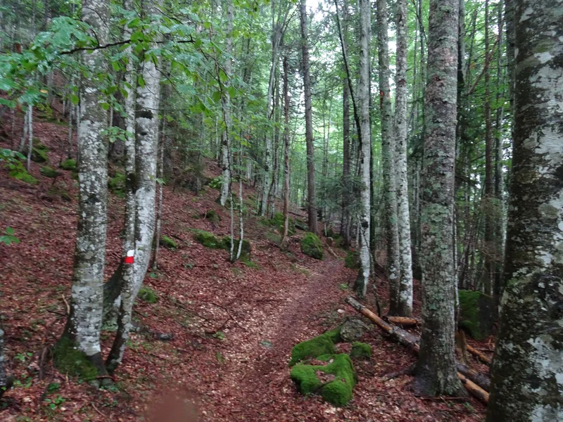
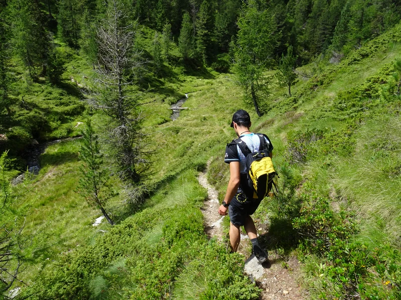
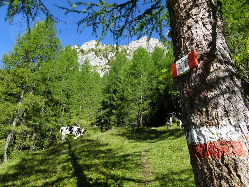
FOREST: The forest is one of the most familiar environments for hikers. Alpine forests are mainly composed of conifers such as larches and red spruce. In the Alps, the tree line is generally found between 2.000 and 2.200 meters, although this elevation varies depending on the aspect of the slope. Climate change is leading to a gradual upward shift of this zone, and it is therefore no longer unusual to find larches at much higher altitudes.
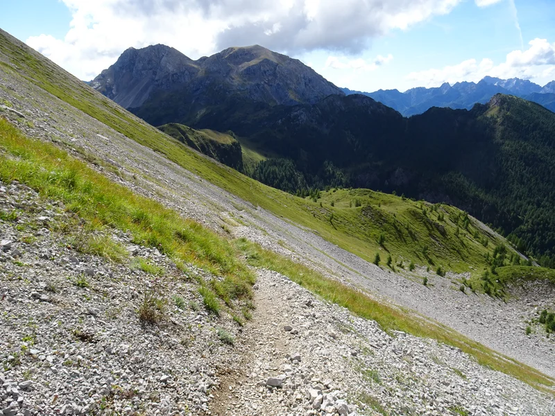
ALPINE MEADOWS: These are wide expanses of high-altitude grassland found just above the tree line. Here the environment is completely open, without trees, and therefore exposed to direct sunlight and all changes in weather conditions. Between June and July, alpine meadows are brightened by numerous alpine flowers and tufts of grass. Trails usually wind uphill with zig-zags across grassy slopes or traverse the mountainsides horizontally. The ground is generally firm, grassy, and sloping; it is easy to walk on in dry conditions but becomes much more slippery when the grass is wet, especially during traverses.
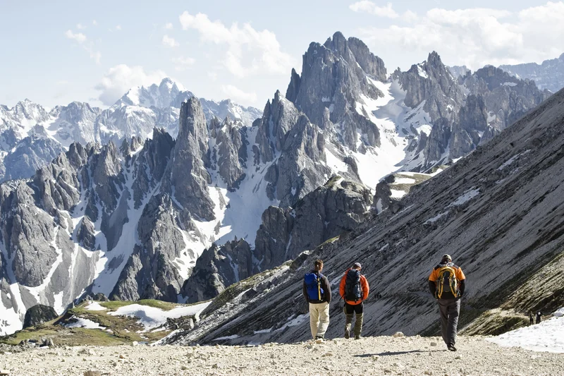
ROCKY TERRAIN: As you continue to gain elevation, alpine meadows give way to steeper slopes where vegetation becomes increasingly sparse. In these environments, rocky surfaces, loose debris, stone blocks, and uneven sections prevail. Walking on rocky terrain requires a steady pace and good balance. Trails are more irregular, with smoothed rock slabs and natural steps, and may occasionally include more “technical” passages.
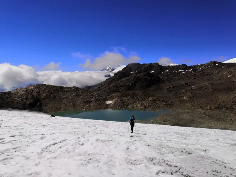
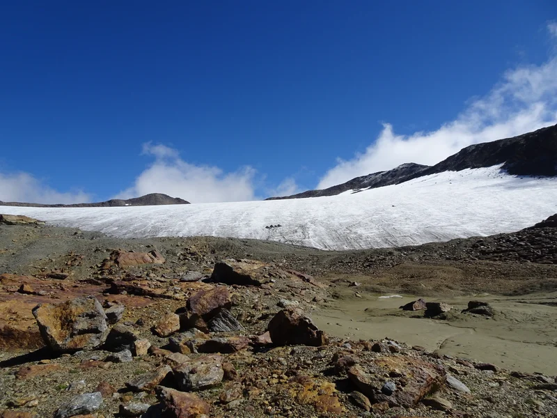
GLACIER AND PERMANENT SNOW: Above 3.000 meters, glaciers and areas of permanent snow are encountered. In these environments, the ground is covered by snow or ice for most of the year. At the beginning of the season, it is sometimes possible to find simple residual snowfields.
TYPES OF TERRAIN
EXPOSED TRAIL: A trail can be described as “exposed” when the hiker is walking alongside a steep slope or a vertical face without natural protective barriers or ample lateral space. In these sections, the trail is still clearly defined and generally wide; these are not airy, narrow ledges. Exposure does not imply technical difficulty, but rather refers to a trail lacking natural protection.
A typical example is a traverse across a very steep grassy slope, a rocky ledge overlooking the valley, or a mountain pass with an immediate descent on the opposite side. In some cases, short sections are equipped with steel cables or metal ropes that can be used as support while moving. Exposed trails are common in alpine meadows and on open slopes, but they can be found anywhere in the Alps. Even the simplest trek may include short exposed sections. To tackle them comfortably, it is important to have sure footing, proceed calmly, and not suffer from vertigo, especially when the ground is wet.
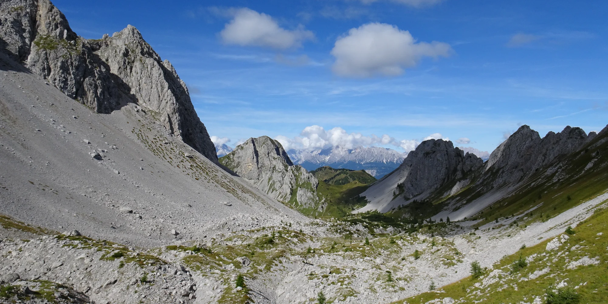
MOUNTAIN PASS: A forcella is a narrow passage between two slopes that allows hikers to move from one valley to another. In the Dolomites, mountain passes are very common and are typically rocky and steep. The terrain is hard, uneven, and steep: the trail climbs decisively on one side and descends just as sharply on the other. The path usually develops through a series of switchbacks across the scree slopes found on either side of the pass. Forcelle are often exposed, but they reward the effort with breathtaking views.

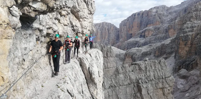
EXPOSED LEDGE: An airy ledge is a narrow natural rock shelf. It is usually horizontal and runs along a steep rock face, with significant exposure to the void below. This type of passage is typical of via ferrata routes.
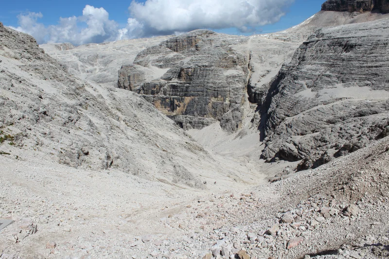
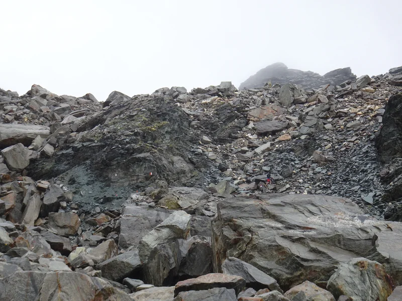
SCREE SLOPE: A scree slope is an expanse of stones and pebbles of varying sizes that forms at the base of rock faces or along steep slopes and gullies. They are very common in the Dolomites, especially below vertical rock walls. Scree is made up of unstable debris resulting from the fragmentation of rock over many years. When walking on scree, the stones tend to shift with every step, making progress slower and more physically demanding.
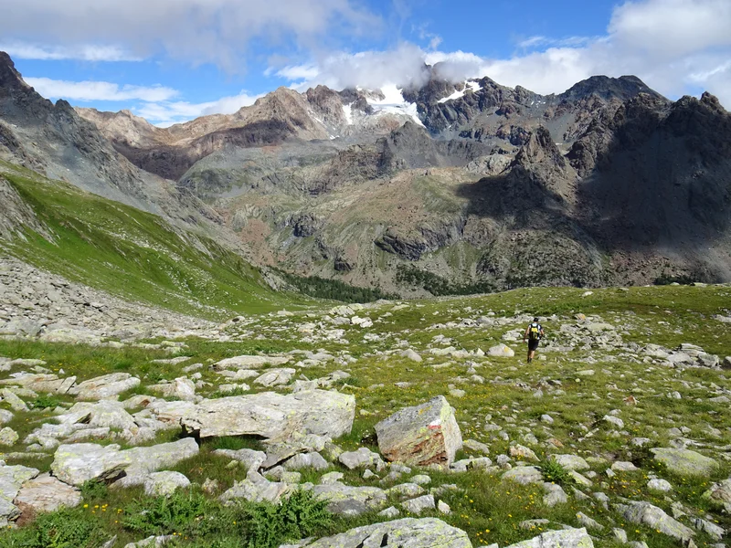
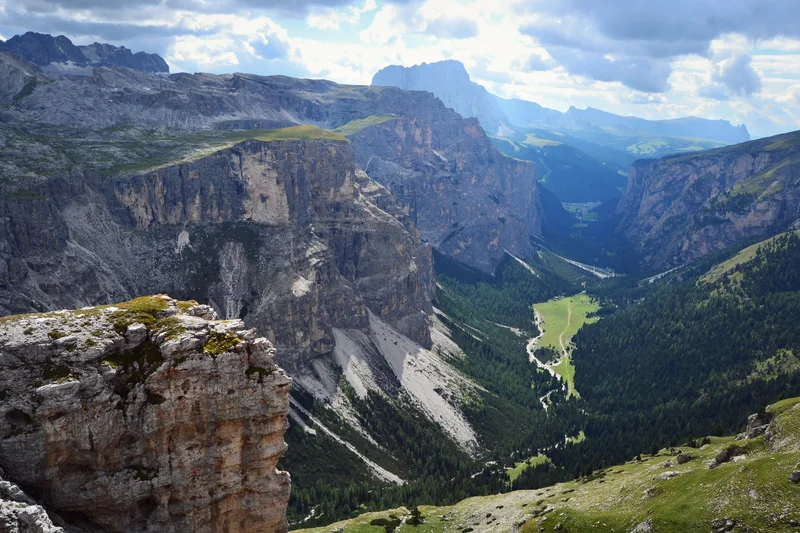
VALLEY: A vallone is a large valley or basin, often of glacial origin. It is frequently covered with meadows or smooth, worn stones. The valley floor can vary from grassy terrain to loose debris and rocky ground.
STEEP GRASSY TERRAIN: This type of terrain consists of grass-covered slopes, often steeply inclined, and is typical of alpine meadows and open mountainsides. In dry conditions it is generally easy and pleasant to walk on. However, when the grass is wet, flattened, or smooth, the ground becomes extremely slippery—especially on traverses. It is a type of terrain that is often underestimated and can become demanding even without any specific technical difficulties.
MIXED TERRAIN: Mixed terrain is a combination of grass, exposed rock, scattered stones, and short sections of loose scree. It is one of the most common types of terrain encountered on mid- and high-altitude alpine treks. The constant variation in footing requires attention and adaptability. Even though it does not involve specific technical difficulties, it can be tiring precisely because of the need to remain continuously focused on foot placement.
MORAINE TERRAIN: Moraines are accumulations of rocky debris left behind by glaciers during their advance and retreat. Moraine terrain consists of a mix of stones of various sizes, soil, and sand, resulting in unstable footing: walking on it requires attention to avoid slipping. Moraines are characteristic of many glacial alpine valleys and areas close to glaciers.
THE TRAILS
In the Alps and the Dolomites, a dense network of trails allows you to explore the mountains in a different way: through hut-to-hut trekking. The trails connect high-altitude huts, mountain passes, valleys, and peaks, and they differ from one another in type and characteristics. It is important to know how to read a map and recognize the trail markings found along the route.
On the maps we provide for your hut-to-hut treks, trails are shown as drawn lines and are accompanied by a reference number.
Below is a brief list of the main types of trail markings that you should be able to recognize on a map.

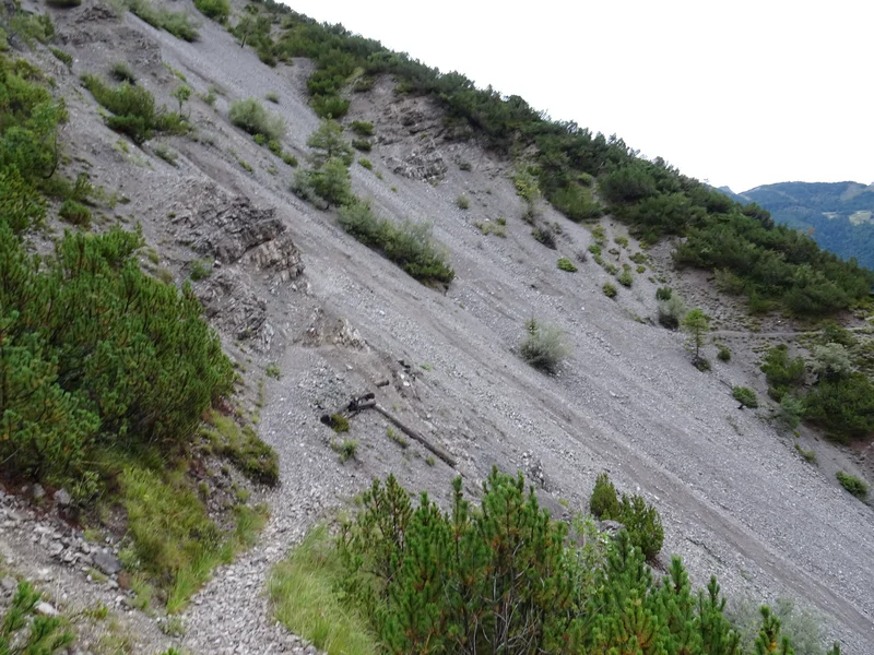
Secondary road that may be paved or unpaved. The white road is a typical forest road made of gravel or compacted dirt. It is usually found at lower elevations.

A mule track or an easy, wide, well-marked trail. Compared to a forest road it is narrower, but it is easier than a standard hiking trail.

A marked trail. This is the classic symbol used to identify hiking trails on topographic maps. It refers to trails classified as E (trail for hikers).

This is still a marked trail, but it may include exposed sections or run across scree slopes or through mountain passes. It refers to trails classified as EE (hiking trails for experienced hikers).

This symbol represents a via ferrata or an equipped trail. A via ferrata is usually identified on the map not only by the XXX markings, but also by the label “Via Ferrata” together with its specific name. In some cases, the XX symbols are also shown within a classic dashed hiking trail (standard hiking path). This indicates that the hiking trail includes a short exposed section that has been made safer with a metal cable to aid progression, where technical equipment is not required.

A hiking trail (dashed) or a difficult trail (dotted) that has no waymarking along the route and is not identified by any number. It can sometimes be faint or hard to see, and the direction may be unclear.
The main type of trail signage you encounter on the paths is the red-and-white waymark.
Painted mainly on rocks, but also on tree trunks and posts, it indicates that you are on the correct route. Alongside the colors, whenever possible, the trail number is also shown, which is useful for orienting yourself with the map.
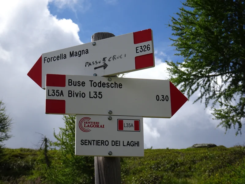
In addition to painted waymarks, you will also encounter directional signposts, which are part of the official CAI (Italian Alpine Club) signage system. These are placed at key points along the route and may provide useful information for your trek, such as destinations (huts, passes, valleys, peaks), estimated walking times, and the trail number.
Finally, in open, rocky areas or at high altitude, you may also encounter cairns, small pyramids of stones used to indicate the route when painted markings are less visible or may be covered by weather conditions.
They are valuable reference points in terrain where the trail disappears among rock, scree, or wide open spaces. Cairns are often built and maintained by hikers themselves: by following them you can confirm the direction, while always remembering to check that they are consistent with the map and with the logical line of the route.